 Marinate
Charts & Navigation
The chart is the app
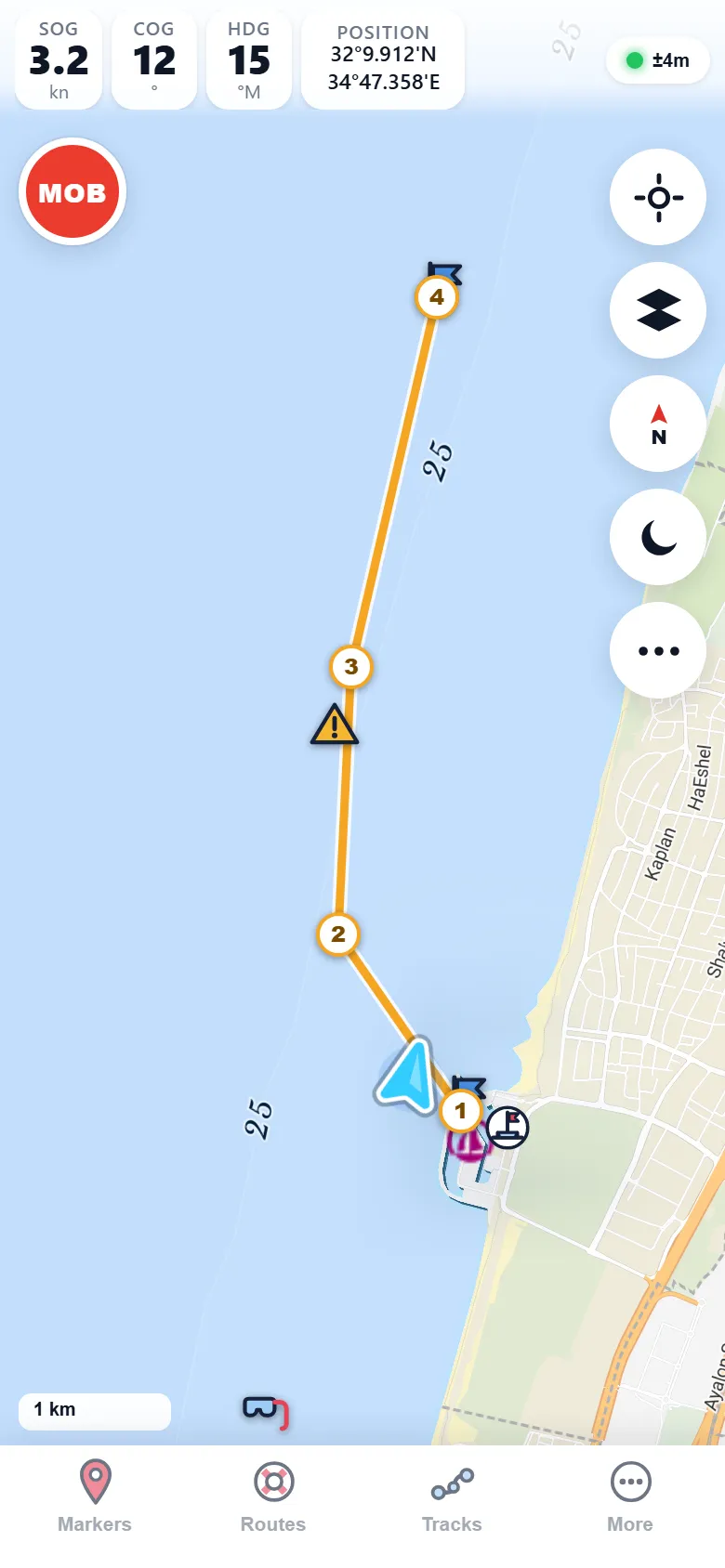
Marinate opens straight onto a full nautical chart — buoys, lights, depths, and marinas drawn from OpenStreetMap and OpenSeaMap — with your boat live on it. No menus to dig through before you can see the water ahead.
Free core forever. No account, no tracking — everything stays on your device.
Seamarks, decoded
Real nautical symbols, not map-app pins
Marinate renders the OpenSeaMap seamark layer over an OpenStreetMap base — the same community data that charts harbours worldwide, drawn the way mariners expect. It's community chart data, not official ENC charts: an aid to situational awareness, never your sole means of navigation.
Buoys & beacons
Lateral and cardinal marks, isolated dangers, and special marks shown with their proper shapes, colours, and topmarks — so the chart reads like the water looks.
Lights & characteristics
Lighthouses and lit marks carry their light characteristics from the community data, helping you match what the chart says to what you see at night.
Depths & soundings
Depth figures and contour lines where the community has charted them, plus optional EMODnet bathymetry shading for a fuller picture of the seabed.
Marinas & harbours
Marinas, anchorages, and harbour facilities on the chart where you need them — and the pilot book can import OpenSeaMap harbour details for the ports you visit.
Base layers & orientation
One tap between four ways to see the same water
The seamark layer sits on top of a base map you choose. Cruising an unfamiliar coast? Switch to satellite imagery to eyeball the reef the chart only hints at. Bright cockpit sun? The light base keeps everything legible. Want nothing but the essentials? Minimal strips the chart down to seamarks and water — and whichever base you pick, you choose which way it points.
Nautical — the default OpenStreetMap base with full OpenSeaMap seamarks.
Satellite — real imagery under your seamarks, ideal for entrances and shallows.
Light — a bright, high-contrast base for daylight glare.
Minimal — a quiet base that lets seamarks and depths do the talking.
Stylized illustration — tap a base. Buoys, lights, and depths stay on top of all four.
North‑up or course‑up — your call
Keep the chart north-up like the paper chart on your nav table, or flip to course‑up so the water ahead of the bow is always at the top of the screen. Course‑up makes pilotage intuitive; north-up keeps the big picture steady while you plan.
- North-up — the chart stays fixed; your boat marker rotates.
- Course-up — the chart rotates under a steady bow-up boat marker.
- Range rings & EBL/VRM — judge distance and bearing off your own position, radar-style.
Depth shading
See the seabed before your keel does
Marinate overlays EMODnet bathymetry as graded depth shading with contour lines. Shallows glow lighter, deep water falls away darker — a glance tells you where the bottom is rising long before a sounding does.
It turns a flat chart into terrain: pick out channels, banks, and drop-offs, and choose an anchorage with the depth profile in view. Pair it with a SignalK depth feed and the shallow-water alarm for a second layer of protection.
Premium Depth shading & contours are one of the Premium layers — the chart itself, and the core safety alarms (MOB and anchor drag), stay free. See pricing.
Live position
Your boat, on the chart, with its future drawn in
A live GPS marker shows your vessel with its heading, and a projected course line shows where you'll be if you hold this speed and course — the fastest possible answer to "are we clearing that mark?" Speed and course over ground, heading, and position in marine degrees-and-decimal-minutes sit one glance above the chart.

Day & night
A red-shifted palette that protects your night vision
Flip to night mode and the whole interface dims and warms: instruments, controls, and readouts turn red on dark, and the chart itself drops to a muted red-on-black palette. Your eyes stay dark-adapted, so when you look up from the screen the horizon — and that unlit mark — is still there.
Day mode is bright and high-contrast for sunlit cockpits; night mode is one tap away when the light goes.
- Red-shifted night palette across the chart, instruments, and controls.
- One-tap switch — no digging through settings in the dark.


Offline first
Charts that don't need a signal
Marinate is built offline-first. Download the chart area you sail before you cast off, and everything — seamarks, base map, your position, your routes — keeps working miles from the nearest cell tower.
Download by area
Frame your cruising ground on screen and download it — every tile in view, plus two zoom levels deeper, saved to the device before you leave the dock.
GPS needs no internet
Your position comes from the GPS chip, not the network. Offline charts plus live GPS means full navigation with the phone in airplane mode.
Everything on-device
Charts, tracks, markers, and the trip logbook live on your phone. No account, no tracking, nothing phoned home.
Offline downloads are free, area by area. Premium lifts the cap with unlimited offline areas — compare plans.
Put the chart in your pocket
Marinate is free forever for core navigation — and the core safety alarms, one-tap MOB and anchor drag, are free always. On the App Store and Google Play.